


MS & AD Insurance Group’s Mitsui Sumitomo Insurance Co., Ltd. and Aioi Nissay Dowa Insurance Co., Ltd. have been operating since June 2021. , Aerosense Co., Ltd. will start a damage investigation in the event of a flood using a fixed-wing drone and AI.
The three companies will accelerate digital transformation and strive to “pay insurance claims as soon as possible.”
BACKGROUND OF THE INTRODUCTION OF THIS SURVEY METHOD
Mitsui Sumitomo Insurance and Aioi Nissay Dowa Insurance Co., Ltd. introduced a flood damage survey using drones and AI from “July 2nd year of Reiwa heavy rain in Kumamoto”, measured the inundation height of houses damaged over a wide area, and the amount of damage. Is calculated. As a result, insurance claims can be paid quickly and non-face-to-face damage investigations are realized.
On the other hand, when the disaster area covers a wide area, it has become a problem that it takes a certain amount of time to shoot with a conventional multicopter drone.
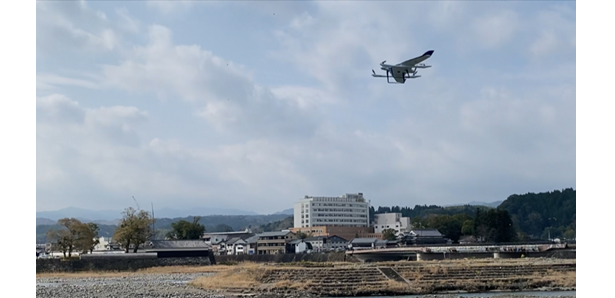
Under these circumstances, Aerosense’s vertical detachable fixed-wing drone (Aero Bowing) introduced, which enables long-term flight and shooting in one flight compared to conventional drones, to further strengthen the damage investigation system.
OUTLINE OF THIS DAMAGE INVESTIGATION
Mitsui Sumitomo Insurance and Aioi Nissay Dowa Insurance Co., Ltd. have introduced a damage investigation method that measures the inundation height by analyzing data using drones and AI fluid analysis algorithms when a flood occurs.
In this survey method, a high-precision surface 3D model of the flood-damaged area is created based on the images taken with a drone, etc., but by utilizing the aero bowing, it is longer than the conventional drone in one flight. It will be possible to shoot the time, and the shooting of the disaster area will be completed in a shorter time.
For example, if the Arakawa River, which is expected to suffer an extremely widespread disaster, is flooded, the conventional drone requires a shooting period of one month or more, but the shooting can be completed in a few days, enabling quicker insurance payment.
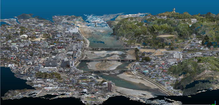
FLOOD DAMAGE INVESTIGATION USING DRONE AND AI
This damage investigation is a highly accurate 3D model of the ground surface that captures the flood-damaged area from the sky with a drone that can identify the coordinates (latitude / longitude) with high accuracy, and possesses accurate coordinates and altitude based on the photographed image. Create a. In addition, the inundation height is calculated by performing data analysis using the AI fluid analysis algorithm * owned by Alicemar. Since it is possible to calculate the amount of damage without conducting a witness investigation, it is possible to pay insurance money to customers at an early stage.
(*) Alicemar’s technology analyzes the amount of water and the flow of water on a map to perform an accurate simulation of the inundation situation.
APPEARANCE AND SPECIFICATIONS OF AEROSENSE AERO BOWING
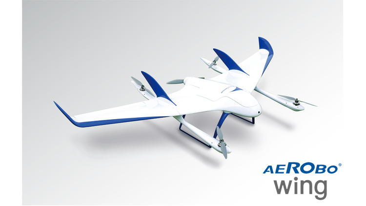
| External dimensions | 2130 x 1250 x 415mm (without propeller) |
| Body weight | 9.0kg (including battery) |
| Maximum usable time | 40 minutes |
| Maximum flight distance | 50km |
| Standard cruising speed | 65km / h |
| Maximum cruising speed | 100km / h |


