


If you’ve ever used GPS for navigation, you know how handy it is to see your exact location on a map. But what if we told you there’s a technology that makes GPS even more accurate? Introducing Real-Time Kinematic (RTK) – a game-changer in the world of Global Navigation Satellite Systems (GNSS).
RTK takes GPS accuracy from meters down to centimeters. Imagine having a personal guide walking beside you, correcting your location as you move. That’s what RTK does.
How Does RTK Work?
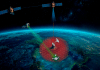
RTK uses two devices: a base station and a rover. The base station stays in one place with known coordinates and receives satellite signals. It calculates the difference between its actual and known coordinates.
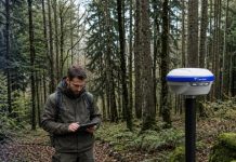
The rover is the device you use for navigation or surveying. It receives signals from the same satellites as the base station. The rover uses the correction data from the base station to figure out its exact position in real-time. This real-time correction allows the rover to be extremely precise.
Benefits of RTK
- High Precision: RTK gives you centimeter-level accuracy, perfect for tasks like land surveying, construction, and farming.
- Real-Time Data: You get instant, accurate positioning information, making it easier to make quick decisions and work efficiently.
- Improved Efficiency: RTK reduces the need for manual adjustments and speeds up data collection, saving you time and money.
- Versatility: RTK is used in many fields, from robotic lawn mowers to drones, and from monitoring buildings to handheld GPS devices.
FAQ:
Q1: What is Real-Time Kinematic (RTK)?
A: RTK is a technology that enhances the accuracy of GPS from meters to centimeters. It provides real-time corrections to your location, ensuring precise positioning.
Q2: How does RTK improve GPS accuracy?
A: RTK uses two devices: a base station and a rover. The base station, located at a fixed point with known coordinates, receives satellite signals and calculates the difference between its actual and known coordinates. The rover, which you use for navigation or surveying, receives signals from the same satellites and uses the correction data from the base station to determine its exact position in real-time.
Q3: What are the benefits of using RTK?
Ans:
- High Precision: RTK offers centimeter-level accuracy, making it ideal for land surveying, construction, and farming.
- Real-Time Data: Provides instant, accurate positioning information, facilitating quick decision-making and efficient work.
- Improved Efficiency: Reduces the need for manual adjustments and speeds up data collection, saving time and money.
- Versatility: Used in various fields, including robotic lawn mowers, drones, building monitoring, and handheld GPS devices.
Q4: What is the role of the base station in RTK?
A: The base station is a fixed point with known coordinates that continuously receives satellite signals. It calculates the difference between its actual position and its known coordinates, providing correction data to the rover.
Q5: How does the rover work in RTK?
A: The rover is the device used for navigation or surveying. It receives signals from the same satellites as the base station and uses the correction data from the base station to determine its precise position in real-time.
Q6: Can RTK be used in various industries?
A: Yes, RTK is highly versatile and can be used in many industries, including land surveying, construction, precision agriculture, robotics, UAV navigation, and building monitoring.
Q7: What is an example of an advanced GNSS solution with RTK capabilities?
A: The UM960 module from Unicore Communications is an example of an advanced GNSS solution with RTK capabilities. It offers a high position fix rate, supports multiple satellite constellations, and has low power consumption, making it ideal for professional use in various applications.
Q8: What makes RTK a game-changer in GNSS technology?
A: RTK’s ability to provide centimeter-level accuracy and real-time data significantly enhances the precision and efficiency of positioning tasks, making it a crucial tool for professionals in multiple fields.