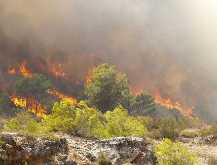
GMV is playing a key role in the European Union’ FirEUrisk project, which aims to find a solution to forest fires
This wildfire season has been one of the worst since the turn of the century. Blazes swept through 660,000 hectares in Europe, more than 298,000 of which were in Spain alone, according to data from the European Forest Fire Information System (EFFIS).
Concerned by these figures and EFFIS’s warning that forest fire risk is set to triple, the European Union decided to act by launching the FirEUrisk project in April last year. European Union’ FirEUrisk project is being carried out under the Horizon 2020 Framework program and aims to deliver a science-based strategy for preventing and fighting forest fires in Europe. The Portuguese Association for the Development of Industrial Aerodynamics (ADAI) is leading a multidisciplinary consortium of 38 institutions from 18 countries in which multinational tech company GMV is playing a key role.
European Union’ FirEUrisk project
European Union’ FirEUrisk project seeks to bolster forest fire management by developing effective solutions and services and generating knowledge to tackle the challenges linked to current European forest fire conditions and those predicted for the coming decades. The main goal of FirEUrisk is to develop a scientific strategy that will prepare ecosystems and society to manage future fires, taking into account differences across Europe in terms of response capacity, operational experience, equipment, and so on.
With a budget of €10,271,044, the project is scheduled for completion in March 2025 and will bring about a paradigm shift in forest fire management. GMV is a crucial player in this international research project, coordinating two particularly important tasks:
- Assessing the cascading effects of forest fires: Cascading effects refer to both the causes and consequences of fires, including higher temperatures, longer dry periods, weaker forest stands due to pests, soil erosion and compaction, increased runoff, landslides, flooding, loss of biomass, and carbon sequestration.
- Demonstrating the proposals in five selected regions across Europe: Kalmar County (Sweden); Central Europe (Brandenburg and Saxony in Germany, Bohemia in the Czech Republic, and Silesia in Poland); Central Portugal; Barcelona, Spain; and Attica, Greece.
A survey is being carried out in these regions to assess regional needs, considering their different communities and fire risks. The aim is to identify their problems and needs in terms of wildfire prevention and protection for the following aspects: wildfire risk assessment, wildfire mitigation and adaptation, and multilevel integration of wildfire risk. The information gathered will be used to show the scalability of the proposed developments: standardized risk indices, prediction models under climate change conditions, evolution of scenarios in new areas affected by fire, technical training content and action protocols for fire brigades, and fire risk reduction for the population, among others.
The worst year in Europe on record
According to data from EFFIS, which is part of the European Commission’s Copernicus program, Spain tops the ranking of European countries with the largest burned area, with more than 298,000 hectares scorched by wildfires, well above Romania (149,344 hectares) and Portugal (104,077).
As the FirEUrisk project coordinator, Domingos Xavier Viegas, full professor at the University of Coimbra, Portugal, said: “We have to prepare for the risk of fires in regions where they did not previously occur and where they are becoming more and more severe. Drawing on the experience of veteran firefighting countries, FirEUrisk is developing guidelines, directives, and recommendations that can also be adopted in central and northern European countries.” He added: “We must act to ready our ecosystems and society, or we may have a very complicated future.”
GMV has been involved for more than 20 years in European Commission-funded projects focusing on aspects such as fire ecology, prevention, suppression, and recovery. Projects such as FirEUrisk demonstrate the usefulness of satellite data for quantifying burned areas, preparing fuel maps, and raising community awareness. Integrating this geospatial data in holistic approaches is crucial to predict, monitor, and evaluate the causes and consequences of fires comprehensively, which will help improve decision-making.
For More information about the project visit: www.fireurisk.eu


