Friday, October 24, 2025
Home Blog Page 245

Rethinking Mobility – Shared Sounds Better

Governments around the world are looking for more convenient ways to provide mobility to citizens. Car sharing became a buzzword in fleet management businesses, describing the transformation in the mobility overall. It reduces the urge for owning a car and helps to contribute to the development of a  greener and more sustainable planet. Responding to this demand, transport telematics companies must adapt and adjust product portfolios as well.

Since Ruptela is working with car-sharing clients locally and globally, we are already shaping this field with experts working alongside us. Meet Arnoldas, one of them, who is leading business development with car sharing in mind.

Some studies declare that 1 car-sharing vehicle can replace up to 13 private cars.

What are the reasons that we are moving from a society where owning a car was one of the most important things to not having one at all?

There are multiple reasons, but it’s worth mentioning two – new social habits and environmental concerns – that influence the development of the shared economy concept in general.

First, we should look at Millennials and Gen Z nowadays – wishing to be flexible, sometimes being afraid of long-term commitments, and living their days faster than any previous generation has ever seen. Those are the main factors why shared economy businesses like Uber or Airbnb have such user growth and success nowadays.

Along the same lines, car sharing perfectly matches requirements for this part of the society – no commitment to owning your car, flexibility to use the car whenever you need, easy accessibility, and no headache thinking about parking fees or annual maintenance.

Second, we do see evident changes in our environment and increasing air pollution; thus, people want to contribute by taking specific action. In terms of transport, shared mobility helps to have less traffic and congestion by reducing the number of cars on the road. Some studies declare that 1 car-sharing vehicle can replace up to 13 private cars. People start to think about the future more responsibly and adjust their habits accordingly.

How are cities around the world adapting?   

There are many good examples of how cities are promoting car sharing, especially the electrical version of it. For instance, Singapore launched the “Electric Vehicle (EV) Car-Sharing Programme” with more than 1000 electric vehicles and around 2000 charging points across the city. The downtown of Madrid, the capital city of Spain, is now accessible for electric or hybrid car-sharing cars only. That’s how Madrid is promoting an approach of being greener and having a town with zero-emission fleets. Another example of Hamburg, which provides free parking places or smaller parking fees for electric vehicles. Thus, it attracts car-sharing companies, which can cut costs on parking fees.

Car manufactures must rethink business flow and focus. How do they react to this inevitable change?  

Well, car manufacturers understand that decreasing car ownership will have an impact on their businesses, so they are also becoming critical players in this industry. For example, BMW and Daimler joined forces by merging their car-sharing companies and launched the ShareNow joint venture. Now it has more than 3 million users in different cities across Europe.

Another example is Volkswagen, which has the most significant concentration of electric vehicles in one place – 1500 cars in Berlin. Furthermore, they are planning to launch services in 8 new cities in 2020. That’s big! In my opinion, car manufacturers and car rental companies will become leading players dominating the car-sharing industry due to their experience in this field and understanding of the customer needs.

We can see many new names joining the shared mobility game. What are the main factors they have to take into account to stay competitive?

In my opinion, three minor pillars can help car-sharing companies to stand out in front of others – accessibility, sustainability, and uniqueness.

Accessibility – most of the time there are enough cars available, so you don’t have to walk long distances. Again, it’s important for Millennials and Gen Z who want to use service immediately.

Another thing related to accessibility is the flexibility to change short-term rent into longer rent, meaning that you can easily use a vehicle for an extended period if plans have changed. Some car-sharing companies introduced multi-city access where you can pick a car in one city and leave it to another town. I do believe this will become quite a significant advantage for some players.

Sustainability – as I said before, people want to contribute to the greener economy and the reduction of carbon imprints. Electric vehicles enable people to act responsibly and show that each of us can participate in shaping a brighter tomorrow. There is a car-sharing company called “Spark” in Lithuania, and its fleet consists of only electric cars. It is a vital factor for a considerable part of society (including me) who are choosing between different car-sharing companies.

Uniqueness – there are plenty of similar companies in the business, but some of them play this game way better than others even when they are offering the same or similar services. Looking at the current business landscape, you have to stand out and stick into the minds of your customers. There can be various ways to achieve this – engaging and playful advertising campaigns, special customer loyalty programs, and even the design of your cars. For example, there is another car-sharing company in Lithuania called “Citybee,” which transforms some of their vehicles during Christmas to look like Rudolph, for example. It’s nice because it gets attention from people and from media, which converts it to free marketing.

Now transport telematics companies must adapt as well. What kind of solutions would make car-sharing businesses life easier?  

I believe that car-sharing companies must rethink their businesses – utilize fleet in most popular locations, manage rentals by giving different price models, and focus on customer attraction with their sales strategies. The rest should be managed by experts developing the appropriate technological solutions. This technical part of the car-sharing technical is quite complicated since it includes reliability, stability, and flexibility for both: software and hardware. We take these pillars very seriously at Ruptela since our goal is to be a reliable technological partner for any car-sharing or car rental company.

How does a person who chooses shared mobility would be described?   

It is very difficult to describe a typical user of such a service. There is no actual definition of one. It depends on many factors, for instance, the type of job one has, the residence area -whether it’s a city center or the outskirts of the city—even the hobbies – everything matters when you think of modern mobility.

The user of shared mobility is both, the shaper of the service as well as the adopter of it. Now people have the freedom to choose from various mobility options such as the type of transportation (e.g., vehicle, scooter, bike) as well as the quality of it – sometimes, you just want to ride that shinning brand new car. Of course, contribution to the fight against global warming is also in the picture – thinking about tomorrow as a better and greener place for us to live. That’s how I see it.

Visit: https://www.ruptela.com/

Telematics platform & mobile app for the fleet’s performance

To help commercial vehicle customers optimize their fleets and make them even more efficient, Ford Commercial Solutions officially launches Ford Telematics, a web-based software platform and subscription service designed to grant fleet managers easy access to important connected vehicle data.

A division of Ford Mobility, Ford Commercial Solutions is dedicated to helping fleets improve their operational effectiveness by offering manufacturer-grade connected vehicle data and information verified by Ford engineers.

Through Ford Telematics, commercial vehicle customers can monitor their fleets with GPS tracking and geofencing, get live vehicle health alerts to plan and limit downtime, set reminders for vehicle service,  analyze driver behavior, and help manage fuel usage to potentially reduce costs.

“Fleet operators and managers are always looking for better ways to improve their business, but they can only do that if they have the right data at hand,” said Michelle Moody, Director, Ford Commercial Solutions. “Ford Telematics not only puts that essential information right at their fingertips, its intuitive interface and mobile companion app for drivers make it even easier to process all that data – meaning businesses can focus on what they do best: serving their customers.”

Ford is offering six months of complimentary access to Ford Telematics on qualified commercial vehicle purchases from now through July 31.* Customers can learn more about Ford Telematics by visiting the Ford Telematics website, and can confirm eligible purchases at fordupfits.com

With Ford Telematics, fleet managers can help:

  • Improve utilization: Keep track of fleet vehicles with GPS tracking and geofencing capabilities. Knowing exactly where vehicles are helps identify which driver is closest to the next call, plan more effectively and get the most out each vehicle.
  • Maximize vehicle availability: Receive proactive notifications and vehicle health alerts to plan and stay ahead. Workflow tools will help schedule services well in advance, avoid costly, unexpected repairs and reduce disruption to fleet operations.
  • Optimize running costs: Minimizing waste is crucial to every business. Fleet Managers can monitor the fuel consumption of all vehicles and identify areas of waste as well as their causes.
  • Protect drivers and vehicles: Manage the fleet and driver compliance every day with a range of notifications, including advance service reminders or a warning if a driver isn’t wearing their seatbelt. This helps managers act quickly and protect their staff, their vehicles and their operation.
  • Improve driver behavior: Valuable insights into driver behavior informs business of coaching opportunities to increase efficiency, reduce waste and improve compliance.

As part of a Ford Telematics subscription, commercial customers will also have access to the Ford Telematics Drive mobile app, which offers a user-friendly way to associate drivers with vehicles and for drivers to report the condition of their vehicles. Digital vehicle checks remove the need to file paperwork, and the app also allows drivers to relay information that may not be readily available through a vehicle’s telematic control unit, such as tire conditions or broken mirrors.

The Ford Telematics Drive mobile app is compatible with both iOS and Android devices, and can be downloaded from the Apple App Store and Google Play.

Ford Telematics takes advantage of Ford vehicles’ built-in modems to transfer data directly from the vehicle to the cloud, and to connect seamlessly with its platform – without the need for additional aftermarket hardware, third-party management or installation downtime. Factory-fitted modems are integrated deep into the architecture of Ford vehicles, enabling the company to engineer the vehicle, the data signals and the modem in tandem to maximize the depth and breadth of data used to develop new solutions for fleet customers.

All 2020 model year Ford and Lincoln vehicles come equipped with factory-installed connectivity. For vehicles already in service without factory-installed connectivity, Ford has developed the Ford Plug-In Modem Kit that businesses can use to ensure they receive data from their entire fleet. This kit uses a y-splitter so that the OBD II port remains free for other uses.

* Offer available on 2020/2021 modem equipped vehicles. Must take new fleet delivery from an authorized Ford Dealer’s stock by 7/31/20, and activate complimentary Ford Telematics 180 day trial by 10/31/2020. Must have an eligible FIN code to participate. Subject to credit approval. May not be combined with other telematics offers. No cash value. Not all features or services will be available in all markets. Subject to monthly charge after complimentary trial period has expired. Cellular networks/vehicle capability/data plan coverage may limit functionality and prevent operation of connected features. Program subject to change.  Go to fordupfits.com/telematics for important terms and conditions.

Orolia’s Virtual Tradeshow Exhibiting Aircraft Solutions

Orolia is pleased to invite the media and the public to our Virtual Orolia Air Show, an online platform to connect with the global aviation industry from the 23-26 June.

As the aviation industry is deeply impacted in daily operations and trade shows are on hold, Orolia is highlighting the importance of aviation technologies with this global event. Attendees can catch up on the latest industry updates and compliance requirements in a series of one-hour sessions. Sign up for free and join as many sessions as you like.

Session topics include the Next Generation Emergency Locator Transmitters (ELTs) for commercial airlines, Combat Search & Rescue Beacons to support critical military missions, Advanced GNSS Anti-jamming and Spoofing Solutions for commercial and military critical infrastructure, as well as Timing and Synchronization Embedded Systems.

Orolia Commercial & Military Aircraft Solutions Exhibit:

What:Orolia Air Show
When:23-26 June, 2020
Where:Virtual Booth (Online Event)- REGISTER HERE

Swift Navigation Demonstrates First-Ever Nationwide Lane-Level Precise Positioning With Ambitious Continental U.S. Drive Test

Swift ​​Navigation​, a San Francisco-based tech firm redefining GNSS and precise positioning technology for autonomous vehicles, today announced the successful completion of a cross-country drive test. The goal of this first-of-its-kind drive, from San Francisco to New York and back, was to measure the efficacy of Swift’s recently expanded Skylark cloud corrections service and to demonstrate true nationwide lane-level GNSS correction coverage at the accuracy, reliability and availability levels required by Swift customers.

The drive took the Swift team across 26 states and Washington D.C. with 6,614.7 miles (10,645.4 km) driven over 116 hours and 14 minutes logged. A Swift vehicle was equipped with 20 different GNSS devices, tested using six unique chipsets that included: Swift’s Piksi® Multi, Duro® and multiple leading GNSS silicon providers. The results of the drive confirmed that Swift’s precise positioning solution—composed of Skylark and the Starling® positioning engine—delivers consistent lane-level accuracy at continental level. Skylark delivered 100% availability, with sub-decimeter accuracy, over the entire United States, wherever cellular coverage was available.

Some performance highlights based on the results from the drive:

  • +Sub-meter horizontal accuracy (2-sigma) achieved across all environments
  • 100% Skylark availability
  • Highly repeatable results with Starling + Skylark across variety of dual-frequency GNSS chipsets

“This is the longest continuous GNSS-based precise positioning drive test of its kind and we are proud of the engineering team at Swift for undertaking this ambitious task,” shared Anthony Cole, Executive Vice President of Engineering. “The results show that Skylark performs as intended and expected in both open sky and urban environments and demonstrate that Skylark is truly a cross-continental corrections network delivering the high integrity and high availability required by automotive OEMs, last-mile applications, rail, mobile and micromobility companies.”

In addition to full Contiguous U.S. (CONUS) coverage, the Skylark corrections service is now available in Europe and is currently being built out to support autonomous applications across the globe.

For more information about how Swift’s precise positioning solution can benefit your autonomous applications, contact Swift at sales@swiftnav.com. Download a complete write-up of this cross-country drive test at www.swiftnav.com

Rohde & Schwarz provides submarine communications solution via NAVICS

Rohde & Schwarz is at the forefront of naval communications systems, offering NAVICS for use onboard surface ships and submerged platforms. Especially communications on the latter are currently receiving great attention.

Communications for submarines is one of the main means to achieve strategic information superiority. With Rohde & Schwarz being at the forefront of naval communication systems, the company offers full integrated communication systems (NAVICS) including line of sight (LOS) and beyond line of sight (BLOS) communications. Here, the company masters the most critical aspect of underwater communications: the communication between the submerged platform and surface vessels, shore stations and airborne assets.

NAVICS is an operationally proven, secure and fully IP based communications system that ensures reliable and secure information exchange and brings the advantages of modern IT technology to today’s vessels. A multilevel security architecture allows secure, trusted and tamper-proof communications between multiple domains of different security classification, such as unclassified, restricted and secret.

The company has equipped Type 214, Type 212 and Type 209 submarines and further submerged platforms with Rohde & Schwarz communication solutions.

“The Rohde & Schwarz equipment provides advanced performance and reliability as well as long-term spare-part supply,” Hansjörg Herrbold, Vice President Market Segment Navy Rohde & Schwarz, says. “Our integrated IP-based communications systems solution is smaller and lighter than TDM based systems, thus saving space, power and weight. Our advanced wireless communications solution provides communications whilst on-the-move.”

The comprehensive range of solutions that Rohde & Schwarz offers, ensures high connectivity and secure and interoperable LOS and BLOS communications for all naval platforms, be they submerged, on the sea, on land or in the air. Rohde & Schwarz meets challenging naval requirements by providing outstanding reliability that enables customers to maintain information superiority in any type of scenario. All Rohde & Schwarz equipment is in line with the relevant MIL-STDs for naval applications and proven in more than 40 navies.

How does the testing of GPS trackers look like at Ruptela?

Ruptela Logo

Various complex activities are essential in order to manufacture Ruptela’s GPS tracking devices and ensure a 99.9% quality rate which Ruptela currently have. It is measured by the international parts per million (PPM) quality performance method. Such a high indicator ranks our GPS trackers among the most reliable and long-lasting products in the market. Numerous people get involved in the development process, making sure that each device meets the highest quality standard. In particular, the crucial role is played by the Research and Development team, which tests new products and use their observations for the further development of the product.

  • Do we drive around for endless hours?
  • Do we put manufactured devices into the thermal chamber?
  • Do we get to crash cars sometimes?

Surely, we do! Depending on the specific telematics solution and the region this solution is tailored for, Ruptela’s R&D team runs various tests to ensure the endurance and applicability of the product.

Main Stages testing a GPS Tracker

Having clients in more than 127 countries and maintaining close relationships with them gives us a chance to involve them in the product development process. Typically, before any of Ruptela’s products are presented to the market, they are tested by our clients under real-life conditions guaranteeing that we receive the feedback from people who use transport telematics solutions in their daily operations. Still, before the device reaches the client, it must go through several technical tests.

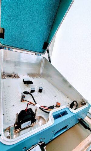
First of all, the hardware device goes to the Radio-frequency anechoic chamber, which creates a controlled electromagnetic environment and allows us to perform highly sensitive testing without any distortion. Retrieved data indicates the capacity of the new device to catch GPS signal, transform this signal to coordinates, and provides more valuable information that is used in the further development of the device.

Radio-Frequency Chamber Ruptela

Radio-Frequency Anechoic Chamber at Ruptela

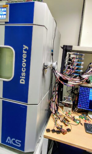
Later, given that GPS trackers contain many electronic components (e.g., batteries), it is essential to run tests in the thermal chamber to check the durability and performance of the device. Once it is placed inside the thermal chamber, the temperature there fluctuates from -40°C to +80°C by adding 5 degrees Celsius the whole day. Depending on the case, a test like this can last from one day to one week or even longer, and as soon as it is over, the report points out the logged issues that the team can react to.

Thermal Chamber Ruptela

Thermal Chamber at Ruptela

Likewise, when we said that we crash cars to test our devices, we didn’t joke about it. Various road traffic accidents happen every day, and fleet owners must get information about the events to see specific data from the accelerometer, for example, shock duration, intensity, and more.  For that reason, Ruptela’s GPS trackers, which are tailored for the light commercial vehicles, have a crash detection functionality detecting traffic collisions and reporting on them (it sends notifications to the user). To be sure that the device recognizes correct incidents, the sensitivity of it has to be very accurate. That’s why we run a test in real-life which includes long preparation process of buying a car, registering the vehicle, finding a safe area for the collisions, taking care of driver’s safety, crashing a car into another one from different angles, analyzing data and gathering insights for improvement. This test provides actual data of an accident, which helps to understand when the accident happened and when it was only a false trigger.

In addition to various tests run by our R&D team at the laboratory, one of the last stages is to install a tracker in the vehicle and drive with it for a few weeks. By this point, it’s crucial to gather and analyze a tremendous amount of data to understand the overall performance of the tracker. Commonly, team members are eager to test trackers with their private cars driving around the country, making a considerable contribution to the product development. However, in some instances, it’s not enough to run test-drives on European roads and our team has to travel miles away to do this in specific regions. This was the case when our Trace5 GPS tracker specifically tailored to the U.S. market was ready for testing in real-life conditions.

Testing LTE CAT M1 (4G) connectivity and GPS performance in the U.S.

Some regions differ from others due to technical characteristics and require extra attention during the testing. For instance, North America differs from other markets in terms of the LTE CAT M1 (4G) connectivity used for IoT devices. For this reason, once the Trace5 tracker was ready for the examination, a more comprehensive investigation was necessary, and our team traveled across the ocean to run multiple tests themselves.

Altogether, our team spent two weeks working on gathering as many insights and information as possible to improve product quality and give the green light to release the product. They started their testing in San Francisco installing a tracking device to the car rented from one of our partners SIXT. States of California, Nevada, Arizona seemed to have perfect conditions to test GNS and GPS performance as there are plenty of objects like skyscrapers, underground parking lots, mountains, and deserts where the connectivity is usually weak.

The first few days were quite challenging as the team had to face unexpected circumstances. Still, after productive communication with SIM card companies, module provider “Quectel” and colleagues at the back office, the team accelerated their pace. Traveling through such locations where the connectivity is weak, revealed that even when there are some network difficulties,  Trace5 doesn‘t let any of the collected data to be lost. The device collects and saves coordinates instantly, and once the signal is back, it sends the data directly to the server. For the sake of reliability and validity of such findings, the team ran tests using multiple SIM card providers and found out that the tracking device tailored for the North American market works perfectly with either of them.

Navigating through underground parking lots, highest skyscrapers, tunnels, traffic jams, mountain roads, or even deserts didn‘t cause any difficulty – the R&D team came back with the thrilling news that the device is ready to be presented to the market. The trip of 3000 km was more than a test of a device – it was also a memorable inscription to the company‘s history.

Laboratory setting and real-life setting tests are needed to ensure that every component of a device is operating as it should and that everything is performing exactly in accordance with the specific requirements. Different tests are valuable at different stages and each test is a vital part of the hardware development process. The synergy between tests of R&D team and client feedback creates the greatest quality GPS trackers in the market.

For more information Visit: https://www.ruptela.com/

Light Commercial Vehicle Tracking Solution by Ruptela

Ruptela Logo

Car and van tracking is the next big thing for tracking business. Here is why our LCV tracking solution is different and why it’s worth your time.

With the new LCV tracking solution, we’ve tackled the main issues with LCV tracking in the market  – difficult installation, warranty and safety issues and of course vehicle model coverage.

LCV tracking solution

This tracking solution for passenger and light commercial vehicles reads manufacturer-specific CANbus data via OBD II port. RPM, speed, fuel level, odometer and other data is received directly from CANbus and with 100% accuracy and safety.

  • Developed using official technical knowledge base from vehicle manufacturers
  • Does not violate vehicles warranty
  • Installation with one harness via OBD II port (Plug&Play)
  • Works with most cars and vans (from 2008)

Professional installation

The tracking device is connected to the vehicles OBD II port using a special harness. After the physical installation, the tracker automatically detects the vehicle model and completes the configuration. 

There is no wire cutting and no other physical manipulation with the vehicle. 

Safe and risk-free

LCV tracking solution does not void vehicles warranty and is 100% safe to use.

  • There is no wire cutting and no other physical manipulation with the vehicle.
  • Communication via OBD II port is based on automotive ISO standards, 
  • Communication is read-only type – there are no configurations or anything done to the vehicle itself.
  • All solution is based on the official technical knowledge bases.
  • Only Ruptela manufactured products used – no 3rd parties involved.

for more information Visit: https://www.ruptela.com/fleet-management-solutions/telematics-solution-for-lcvs/

Drone industry investments grow by 67% to record high at $1.2 billion

Data acquired by Finbold.com indicates that by the end of 2019,
total investment in the drone industry was a record-high of $1.2
billion, a Year-Over-Year growth of 67%. According to the data, venture
capital funding stood at $930 million at the end of last year.

VC FUNDING ACCOUNTS FOR 68.87% OF ALL DRONE INDUSTRY INVESTMENT

The data indicates that between 2008 and 2019 funding in the sector
stood at $4.43 billion while venture capitalists pumped in a total of
$3.46 billion by last year. In general, drone investment through VC
represented 68.87% of all funding. There was a significant spike in the
investment between 2012 ($42 million) and 2013 ($121 million) with a
growth of about 188.1%.

Venture Capital funding joined the drone sector by only $2 million in
2010, a figure that has been rising to hit $930 million in 2019. The
interest from venture capitalists was notable between 2013 and 2014 when
the investment grew by 122.5%. On a yearly basis, the VC funding has
ranged from $450 million to $550 million over the past four years before
the 2019 spike.  According to the report:

“The drone industry has been growing with investment being pumped in
at least 52 companies. Some of the big players in the sector include 3D
Robotics, DJI, Toyota, Boeing, Audi, Airbus, DroneBase, Microsoft among
others. The research notes that even though different companies are
receiving fundings from venture capitalists, most of them are based in
the United States.”

With the recent growth in investment, the drone industry is expected to
witness an increase in funding across 2020. The growth will mainly be
fueled by an increase in drone adoption across the globe.  

READ THE FULL DATA STORY WITH CHARTS HERE:
https://finbold.com/drone-industry-investments-grow-by-67-to-record-high-at-1-2-billion/

SARA new drone project to save lives at sea

SARA new drone project to save lives at sea

The semi-autonomous tethered drone of SARA (Search And Rescue Aid using   high-accuracy EGNSS) is its new project that has been developed for Search and Rescue (SAR) and Surveillance operations and has come out to be a very efficient and great solution because of the drone’s high accuracy, extended flight time providing the 24 hours solution during the operation.

This tethered drone offers the extended observation of horizon, increased flight time and allow the user to fully concentrate on the rescue mission and especially during the hours of darkness the drone support the vessels for the detection of lost people in the sea.

 Composition of the system:

  • Tethered multi-copter drone: equipped with two interchangeable payloads with up to 180x optical /digital zoom or high resolution cameras and a thermal infrared for night vision.
  • Hanger: A ground station customized for tethered search and rescue and continuous surveillance operations which provide unlimited power to drone.
  • A user terminal: The front end of the SARA system is installed on a Pickup Vehicle or a Vessel’s Bridge for surveillance applications.

Major benefits of the system:

  • High accuracy GNSS receivers: The system uses Galileo-enabled GNSS receivers for target identification, localisation and for navigation and control providing high-accuracy at the decimeter level. These two high-accuracy Galileo GNSS receivers allows accurate and a reliable following mode without giving mechanical stress to the cable.

The GSA Head of Market Development Fiammetta Diani said, “Search and rescue is a core service of the Galileo programme. By taking advantage of Galileo’s accuracy to assist in rescue operations and help save lives, innovative solutions like those offered by SARA project are at the heart of the GSA’s mission of linking space to user needs.”

  • 24-hour solution: The SARA system offers a top view moving ‘eye’ which is installed on board of a ship, a car or any other ground or sea vehicle. Because of the synchronization of flight data with the HANGER, the drone autonomously follows the vehicle while moving.

The thermal infrared vision support rescuers operating at night which enable them to detect the lost people in the sea particularly during the time of darkness. During the course of project, the SARA system had undergone some tests for maritime Search and Rescue in day and night operations. In the night time, the survivors in the sea have been detected up to 700 meters away and also a 15 meter long boat has been identified 12 km away from the ship.

  • Secure communication: The data is transferred using wired interfaces which make the communications between Drone, the User terminal and Hangar totally secure.

The stakeholders of National Institute for Oceanography and Applied Geophysics (OGS) Italy have expressed their interest in SARA project for using the system to increase safety on icebreakers. The benefits which SARA offers have also got attention of its 22 supporting organizations all over the Europe for their needs. This project has successfully concluded the engineering stage and now the team is looking forward for commercialization and industrialization stage with the bright future ahead.

ADVA enhanced Oscilloquartz portfolio for power utility networks

ADVA has recently announced the upgraded version of its complete Oscilloquartz  PTP grandmaster clocks portfolio to meet the frequency, phase synchronization and latest PTP profiles for time in power utility networks so as to modernize the utility infrastructure .This enhanced technology is based on Precision Time Protocol (PTP) power profiles which can simultaneously maintain the legacy timing of signals.

With the help of this technology, the power network operators can get the stable synchronization with accuracy which is required to develop the smart grid power networks built on packet-based solutions. The Oscilloquartz includes a fully redundant hardware, OSA 5401 small form-factor pluggable, the OSA 5420 Series, the highly scalable OSA 5430 and 5440 with 10Gbit/s interfaces and the OSA 5405 for indoor and outdoor substation deployments.

The Oscilloquartz ‘s small compact cell device, a medium sized PTP grandmasters with a pluggable solution ensure the correct timing throughout the utility network due to its superfluous core timing technology which removes the dependency on satellite based time sources as it uses AI-assisted analytics and provide continuous monitoring, jamming and spoofing detection.

Gil Biran, the general manager of Oscilloquartz , ADVA said , “Our technology provides a clear and cost-efficient path to robust and future-proof utility network synchronization. Its PTP timing delivery complements and replaces legacy protocols, enabling the accurate and resilient timing needed for emerging intelligent applications. Along with our multi-constellation GNSS receivers, PTP backup is also essential for protecting critical power networks. This ensures efficient operations and the best protection from malicious attacks.”

This technology allow an easy migration to a timing network based on Ethernet with support for PTP, IRIG-B, PPS and BITS legacy interfaces, Network Time Protocol (NTP) and SyncE . During long GNSS outages, the advanced monitoring capabilities and the combination of PTP-based backup with multi-band GNSS receivers ensure the highly reliable delivery of precise timing information. ADVA’s Oscilloquartz cesium clocks together with the OSA 5420, 5430 or 5440 can create an ePRTC solution which can delivers extended holdover of up to 70 nanoseconds for 14 days, even during the unavailability of GNSS signals.