Thursday, October 23, 2025
Home Blog Page 246

Can drones be our front line heroes during a crisis?

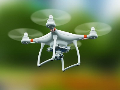
Drones are one of the hottest pieces of upcoming consumer tech. The ability to experience flight and explore the surroundings from the comfort of your backyard has a clear appeal. However, these tiny flying robots also have a lot of non-recreational purposes — some of which can even help in emergencies.

India has only recently begun warming up to the idea of unmanned aerial vehicles (UAVs). This slower adoption is understandable considering the privacy and safety questions that arise. While enthusiasts are yet to find luck with them, the ongoing Covid-19 pandemic might just be the catalyst that drones needed in India.

Drone primarily refers to an unmanned aerial vehicle. They come in small packages and can be controlled via a smartphone or a dedicated drone controller. They are becoming a serious business in India and startups from in the country are at the forefront in adopting latest technology.

Drones can be used in several scenarios. Beyond the obvious recreational purposes, they can be used to deliver essentials, medical equipment, and for a variety of uses in the current pandemic. They can be used for public surveillance, announcements, spot situation analysis, monitoring, etc.

In fact, it is in the lockdown timeframe that we saw the first wave of surveillance and monitoring come into action. Here’s how Indian startups are planning to use drones in emergency situations, and what we can expect from them in the future.

Why drones during an emergency?

Drones require minimal human interaction. A pilot can navigate the UAV to different locations and complete the task while staying safe and being miles away from the red zones.

In certain emergency situations such as a natural disaster or the lockdown, drones can be life savers. They can provide rapid awareness, help firefighters locate the hot spot during fire hazard, can be utilised in military operations, in transportation of organs, public surveillance, delivery of essentials and medicines. And, all of this can be achieved without any need for human contact, further reducing risk of life.

Why haven’t drones become mainstream in India?

Regulations around drones in India are a grey area. There are multiple overlapping laws, with more in the pipeline. This makes the ownership of drones a pretty complicated affair. According to the latest Civil Aviation Requirement drone policy, pilots in India need to get a NOC from a web portal for undertaking aerial survey with the final permission of DGCA.

All drones in the country must be registered on this portal. Information such as the drone’s dimensions and weight, owner’s Aadhar card and other essentials are recorded. A unique “digital number plate” will be created to track the drone in case of a mishap.

Legalities aside, there are also various other factors hindering the adoption of drones. Firstly, serviceable drones are not affordable. Anything with a decent range and a reliable camera burn a very large hole in the pocket. And the more capable they get, the more cost-prohibitive it becomes. There are very few authorized drone retailers in India who keep driving up the prices for the imported units.

Spirent SimHIL Brings Realistic GNSS Simulation to Automotive HIL Testing

Spirent Communications plc the world leader in global navigation satellite systems (GNSS) testing solutions, has today announced the release of SimHIL, an integrated hardware-in-the-loop (HIL) testing software API for Spirent GNSS simulators. SimHIL brings high fidelity GNSS signal simulation with low latency to automotive industry HIL testbeds. 

Spirent’s SimHIL software has been developed to meet the automotive industry’s growing need for realistic positioning, navigation and timing testing for sensor fusion. As customers apply increasing pressure on car manufacturers for more advanced driver-assistance system (ADAS) features and advanced infotainment systems, test labs need to be able to combine Wi-Fi, camera, lidar, radar, inertial and GNSS data that power these advanced automotive systems. 

SimHIL helps test engineers bring accurate, controlled and coherent data from GNSS and inertial sensors to their sensor fusion algorithms within HIL test environments. Facilitating the ultra-low latency, complete control, enhanced realism, and ease of use and setup of Spirent GSS7000 and GSS9000 GNSS simulators, SimHIL is an ideal solution for OEMs and tier-one suppliers developing ADAS, V2X and sensor fusion engines. 

The new SimHIL API enables: 

  • External motion input – real-time direct motion and trajectory data input from simulators.
  • Sensor fusion – introducing GNSS signals into sensor fusion engines.
  • V2X testing – validation and performance benchmarking of V2X applications.
  • Infotainment system testing – real-time scenario feedback to system and driver responses.
  • Vehicle-in-the-loop (VIL) – final production form product testing.
  • Accurate testing – reliable results supported by ultra-low latency simulation. Criticality of ADAS features, such as lane assist and automatic braking, mean that 3+ metres of uncertainty introduced by higher latency systems is not sufficient.

Martin Foulger, General Manager of Spirent’s Positioning, Navigation and Timing Business said: “With our SimHIL software and GNSS simulators, test engineers can bring realistic, controlled GNSS simulation to their HIL testing environments – a vital requirement in a world where ADAS features are relying more heavily and critically on accurate positioning.”

Spirent has worked with leading suppliers to ensure SimHIL is compatible with their HIL platforms and because of its open API, there’s broad scope for additional custom third-party integrations.

“When used with our GSS7000, SimHIL latency is less than 40ms from motion command to RF output and supports all GNSS and SBAS signals,” said Ricardo Verdeguer Moreno, Product Manager for Connected and Autonomous Vehicles at Spirent. “SimHIL is also compatible with all the options and features available in Spirent’s GNSS simulators, including ionospheric and tropospheric modelling, antenna patterns, date and time settings, and obscuration and multipath effects via Sim3D.”

Users can easily configure and control both the GNSS scenarios, and signal generation and vehicle motion from within the HIL simulator GUI – saving time and the possibility of error.

Spirent is also offering three service packages alongside SimHIL to help customers mitigate project risk and reduce the time from delivery to useful deployment. 

For more information about Spirent’s SimHIL integrated testing for Spirent GNSS simulators, visit the SimHIL information page.

SPH Engineering Announces a Bathymetric Drone Solution

SPH Engineering announces the launch of a new product to make bathymetric surveys of inland and coastal water. An Unmanned Aerial Vehicle (UAV) drone integrated with an Echo Sounder is time- & cost-efficient and suitable for mapping, measuring and inspecting tasks as well as environmental monitoring.

A UAV drone equipped with an Echo Sounder allows to collect data with high accuracy faster due to easy transportation and fast deployment and it is 2 times more cost-efficient compared to the traditional methods. It has the ability to operate at hard to reach locations, unsafe or hazardous environment. Locations not reachable by foot or dangerous for a human (steep coasts, mining pits, contaminated waters, terrain obstacles etc.) as well as waters of ponds, lakes, and canals can be reached by a drone.

“Since autumn 2018 we have been getting bathymetry-related requests. Analyzing about 150 inquiries we have come to the conclusion that a drone-based solution could open a new business opportunity for drone service companies to do bathymetry surveys of coastal and inland water especially those for industrial needs. Compared with a standard approach using a boat or an unmanned surface vehicle, a drone could save a lot for its user. An Echo Sounder itself could be integrated into a client’s drone with no need to purchase additional equipment. Moreover, it is small and easy to transport and operate. At the same time, such research method guarantees data accuracy and employee safety”, Alexey Dobrovolskiy, CTO of SPH Engineering, comments.

for more information visit: https://sph-engineering.com/

iFoodDecisionSciences Acquires Trimble’s HarvestMark Business

Trimble announced today that iFoodDecisionSciences, Inc. (I foods) has acquired Trimble’s HarvestMark business, a provider of food traceability and quality inspection solutions. Financial terms were not disclosed.  

iFoodDS, a leading provider of food safety and process control software solutions, has worked closely with Trimble’s HarvestMark business. In 2018, the companies partnered to deliver an integrated supply chain solution for food safety, traceability and quality management. This collaboration was demonstrated in the Western Growers Food Safety Risk Management Program, which was announced in 2019. The acquisition of HarvestMark lays a strong foundation for iFoodDS to maximize the effectiveness of a combined solution for current and potential customers.

“The collaboration between iFoodDS and HarvestMark during the past year developed into a tightly integrated solution for customers,” said Darryl Matthews senior vice president, Trimble’s Resources and Utilities Segment. “As Trimble evaluated the long-term success of HarvestMark, the optimal solution was to sell the business to iFoodDS, allowing Trimble to focus on its core strategy to increase farm operational efficiencies in the field. We look forward to continuing to collaborate with iFoodDS, enabling Trimble’s farming customers to leverage an integrated food safety, traceability and quality control solution as part of their overall operations.”

iFoodDS delivers an integrated supply chain solution for food safety, traceability and quality management. By integrating HarvestMark’s traceability and quality inspection information with iFoodDS’ real-time food safety data, the combined company will offer a comprehensive supply chain management platform that can significantly benefit fresh produce grower/shippers, packers, distributors, foodservice companies and grocery retailers globally.

“iFoodDS and HarvestMark have a demonstrated track record of simplifying the burdensome task of collecting and documenting process control data, which is required today in the food industry. Our years of collaborating have taken our work to the next level by providing real-time visibility throughout the supply chain,” said Diane Wetherington, CEO of iFoodDecisionSciences. “The decision to acquire HarvestMark is driven by our mission to further enable customers to minimize their supply chain risks and allow them focus on the business of growing and selling food.”

This combined solution is unique in the industry. It enables streamlined management of day-to-day food safety and quality control risks—regardless of where they occur in the supply chain—by providing traceability, both at the lot and item level, with continuous real-time tracking of food safety practices. The solution provides greater transparency, enhanced quality and unparalleled safety for food companies, retailers and consumers by enabling meaningful analysis of food ‘from farm to the fork’ across the entire supply chain. 

“iFoodDS is committed to helping advance continuous food safety improvements throughout the produce supply chain,” added Wetherington. “This acquisition is a further step in that commitment and our goal to be a strong partner to companies who work diligently to provide safe and healthy fruits and vegetables to consumers.”  

HarvestMark has been reported as part of Trimble’s Resources and Utilities Segment. The sale will not have a material impact on the reporting segment or overall financial results.

Septentrio strengthens its inertial GNSS portfolio with AsteRx-i D UAS

Septentrio, a world leader in high-precision GNSS positioning solutions, has announced today a new GNSS*/INS receiver, AsteRx-i D UAS. This multi-frequency receiver combines reliable centimeter-level positioning with 3D orientation, enabling automated navigation of aerial drones and robots. With a high-performance IMU (Inertial Measurement Unit) from Analog Devices integrated directly into the board, AsteRx-i D UAS is compact and lightweight. Aboard the drone, its small form-factor combined with exceptionally low power consumption results in extended battery life and longer flight times.

“With this product we introduce into our inertial-GNSS portfolio an IMU which allows us to reduce the weight and power consumption of our UAS boards while making them easier to integrate. These are all key elements for a successful UAV platform.”

AsteRx-i D UAS is the first commercial product resulting from Septentrio’s collaboration with Analog Devices, delivering robust positioning and attitude (heading, pitch and roll) in demanding industrial environments. Both single antenna and dual antenna versions are available. The single antenna version provides a lightweight solution optimizing the system SWaP (size, weight and power). The dual antenna version is ideal for machines that need reliable heading directly from the start.

AsteRx-i D UAS comes with industry-leading Advanced Interference Mitigation (AIM+) technology. In aerial drones, where many electronics are crammed into a small space, neighboring devices can emit electromagnetic radiation, interfering with GNSS signals. AIM+ offers protection against such interference resulting in faster set-up times and robust continuous operation. The on-board IMU from Analog Devices is exceptionally robust against mechanical vibrations. This IMU combined with Septentrio’s anti-shock LOCK+ technology makes AsteRx-i D UAS resilient against impact during takeoff and landing.

Septentrio’s online shop offers direct access to the company’s latest GNSS technology. The AsteRx-i D UAS evaluation kit is now available online at shop.septentrio.com/asterxiduas. For more information about AsteRx-i D UAS contact sales@septentrio.com.

* Global Navigation Satellite System including the American GPS, European Galileo, Russian GLONASS, Chinese BeiDou, Japan’s QZSS and India’s NavIC.