Friday, October 24, 2025
Home Blog Page 245

Drone industry investments grow by 67% to record high at $1.2 billion

Data acquired by Finbold.com indicates that by the end of 2019,
total investment in the drone industry was a record-high of $1.2
billion, a Year-Over-Year growth of 67%. According to the data, venture
capital funding stood at $930 million at the end of last year.

VC FUNDING ACCOUNTS FOR 68.87% OF ALL DRONE INDUSTRY INVESTMENT

The data indicates that between 2008 and 2019 funding in the sector
stood at $4.43 billion while venture capitalists pumped in a total of
$3.46 billion by last year. In general, drone investment through VC
represented 68.87% of all funding. There was a significant spike in the
investment between 2012 ($42 million) and 2013 ($121 million) with a
growth of about 188.1%.

Venture Capital funding joined the drone sector by only $2 million in
2010, a figure that has been rising to hit $930 million in 2019. The
interest from venture capitalists was notable between 2013 and 2014 when
the investment grew by 122.5%. On a yearly basis, the VC funding has
ranged from $450 million to $550 million over the past four years before
the 2019 spike.  According to the report:

“The drone industry has been growing with investment being pumped in
at least 52 companies. Some of the big players in the sector include 3D
Robotics, DJI, Toyota, Boeing, Audi, Airbus, DroneBase, Microsoft among
others. The research notes that even though different companies are
receiving fundings from venture capitalists, most of them are based in
the United States.”

With the recent growth in investment, the drone industry is expected to
witness an increase in funding across 2020. The growth will mainly be
fueled by an increase in drone adoption across the globe.  

READ THE FULL DATA STORY WITH CHARTS HERE:
https://finbold.com/drone-industry-investments-grow-by-67-to-record-high-at-1-2-billion/

SARA new drone project to save lives at sea

SARA new drone project to save lives at sea

The semi-autonomous tethered drone of SARA (Search And Rescue Aid using   high-accuracy EGNSS) is its new project that has been developed for Search and Rescue (SAR) and Surveillance operations and has come out to be a very efficient and great solution because of the drone’s high accuracy, extended flight time providing the 24 hours solution during the operation.

This tethered drone offers the extended observation of horizon, increased flight time and allow the user to fully concentrate on the rescue mission and especially during the hours of darkness the drone support the vessels for the detection of lost people in the sea.

 Composition of the system:

  • Tethered multi-copter drone: equipped with two interchangeable payloads with up to 180x optical /digital zoom or high resolution cameras and a thermal infrared for night vision.
  • Hanger: A ground station customized for tethered search and rescue and continuous surveillance operations which provide unlimited power to drone.
  • A user terminal: The front end of the SARA system is installed on a Pickup Vehicle or a Vessel’s Bridge for surveillance applications.

Major benefits of the system:

  • High accuracy GNSS receivers: The system uses Galileo-enabled GNSS receivers for target identification, localisation and for navigation and control providing high-accuracy at the decimeter level. These two high-accuracy Galileo GNSS receivers allows accurate and a reliable following mode without giving mechanical stress to the cable.

The GSA Head of Market Development Fiammetta Diani said, “Search and rescue is a core service of the Galileo programme. By taking advantage of Galileo’s accuracy to assist in rescue operations and help save lives, innovative solutions like those offered by SARA project are at the heart of the GSA’s mission of linking space to user needs.”

  • 24-hour solution: The SARA system offers a top view moving ‘eye’ which is installed on board of a ship, a car or any other ground or sea vehicle. Because of the synchronization of flight data with the HANGER, the drone autonomously follows the vehicle while moving.

The thermal infrared vision support rescuers operating at night which enable them to detect the lost people in the sea particularly during the time of darkness. During the course of project, the SARA system had undergone some tests for maritime Search and Rescue in day and night operations. In the night time, the survivors in the sea have been detected up to 700 meters away and also a 15 meter long boat has been identified 12 km away from the ship.

  • Secure communication: The data is transferred using wired interfaces which make the communications between Drone, the User terminal and Hangar totally secure.

The stakeholders of National Institute for Oceanography and Applied Geophysics (OGS) Italy have expressed their interest in SARA project for using the system to increase safety on icebreakers. The benefits which SARA offers have also got attention of its 22 supporting organizations all over the Europe for their needs. This project has successfully concluded the engineering stage and now the team is looking forward for commercialization and industrialization stage with the bright future ahead.

ADVA enhanced Oscilloquartz portfolio for power utility networks

ADVA has recently announced the upgraded version of its complete Oscilloquartz  PTP grandmaster clocks portfolio to meet the frequency, phase synchronization and latest PTP profiles for time in power utility networks so as to modernize the utility infrastructure .This enhanced technology is based on Precision Time Protocol (PTP) power profiles which can simultaneously maintain the legacy timing of signals.

With the help of this technology, the power network operators can get the stable synchronization with accuracy which is required to develop the smart grid power networks built on packet-based solutions. The Oscilloquartz includes a fully redundant hardware, OSA 5401 small form-factor pluggable, the OSA 5420 Series, the highly scalable OSA 5430 and 5440 with 10Gbit/s interfaces and the OSA 5405 for indoor and outdoor substation deployments.

The Oscilloquartz ‘s small compact cell device, a medium sized PTP grandmasters with a pluggable solution ensure the correct timing throughout the utility network due to its superfluous core timing technology which removes the dependency on satellite based time sources as it uses AI-assisted analytics and provide continuous monitoring, jamming and spoofing detection.

Gil Biran, the general manager of Oscilloquartz , ADVA said , “Our technology provides a clear and cost-efficient path to robust and future-proof utility network synchronization. Its PTP timing delivery complements and replaces legacy protocols, enabling the accurate and resilient timing needed for emerging intelligent applications. Along with our multi-constellation GNSS receivers, PTP backup is also essential for protecting critical power networks. This ensures efficient operations and the best protection from malicious attacks.”

This technology allow an easy migration to a timing network based on Ethernet with support for PTP, IRIG-B, PPS and BITS legacy interfaces, Network Time Protocol (NTP) and SyncE . During long GNSS outages, the advanced monitoring capabilities and the combination of PTP-based backup with multi-band GNSS receivers ensure the highly reliable delivery of precise timing information. ADVA’s Oscilloquartz cesium clocks together with the OSA 5420, 5430 or 5440 can create an ePRTC solution which can delivers extended holdover of up to 70 nanoseconds for 14 days, even during the unavailability of GNSS signals.

Focus Telecom installed a GPSdome unit for GPS cyber protection of the GPS/GNSS signals

Focus Telecom announced today that under its support and maintenance contract of all of its “National Time” systems at INPL (Israel National Physics Lab) in Jerusalem, it had installed a GPSdome unit for GPS cyber protection of the GPS/GNSS signals.

The GPSdome cyber protection system, developed by infiniDome, an Israeli startup company, will be tested and measured by INPL’s own Dr. Nadya Goldovsky, on its ability to protect the received satellite signals of the international time (UTC) from the GPS/GNSS satellites and the Israeli national clock from jamming attacks and other interferences, along with a cloud-based monitoring system that will report any attack in real-time.

“GPSdome is a cyber protection system developed based on military technologies and principals which was adapted to non-military, commercial use”, said Omer Sharar, infiniDome’s CEO. “Our systems are already deployed and operational in Israel at multiple sites in the defense/HLS sector, border protection, financial sector, and telecom sector. Recently, infiniDome has signed a global distribution contract with an international PNT solution provider to sell its GPSdome systems in over 120 countries.”

“The market for GPS/GNSS protection systems, especially against jamming, spoofing, and other interferences, is growing rapidly across the world as a response to the rising number of attacks by use of cheap, easily obtainable jamming and spoofing devices”, said Gai Mar-Chaim, senior partner at a strategic consulting company, POC. “Markets and Markets research company, published a recent report in which it predicts the market to grow beyond $5B as early as in 2022”.

Automotive radar – seeing with radio waves

Automotive Radar

Test solutions in a complex world: the 5th generation of radar systems is under development

With the new autonomous and accident-free driving vision, radar sensors together with other sensors such as Lidar, cameras and ultrasound are becoming a key technology for current and future advanced driver assistance systems (ADAS). Radar sensors are already being introduced in today’s vehicles in order to avoid critical situations and reduce the overall number of accidents.

The radar sensor is considered an essential pillar of road safety since it enables a detailed image of the surroundings, mainly independent of environmental influences. The 77/79 GHz frequency ranges with higher bandwidths (up to 4 GHz) feature increased range resolution of only a few centimeters. Today, fast chirps, which are more susceptible to interference than slow frequency modulated continuous wave (FMCW) signals, are used for better object recognition.

Your challenges

However, when ensuring driver assistance functions, multiple challenges arise. New legislation such as UN ECE R79 CAT C (for lane change assistant) and the radio equipment directive (RED) require improved quality assurance. The accuracy of mounting automotive radar systems in production lines and repair shops needs to be optimized as well. Additionally, hardware-in-the-loop testing of radar systems using moving target simulation will gain more importance in the future.

Benefits of our solutions

  • Less development effort through using Rohde & Schwarz technology and products in all areas – from R&D to production
  • Increased quality of your developments using industry-proven products, e.g. high-tech body scanners in airports and radar testing technology in the aerospace and defense market
  • Optimal education of your engineers with training from the market leader in high frequency
  • Secure, future-proof investments in products from a supplier who strategically focuses on automotive radar technology

For more detailed information, Visit: “Excellence in precision solutions of automotive radar“.

Anritsu Achieves 3GPP Approval for World’s First 5G Aggregation Test

Anritsu Corporation is pleased to announce that it has achieved approval for the world’s first 5G New Radio (NR) Standalone (SA) test for Carrier Aggregation. The tests are based on 3GPP TS 38.523 and were approved by 3GPP RAN5 working group in Frequency Range 1 (FR1). Anritsu has subsequently also achieved 3GPP approval for Carrier Aggregation testing for 5G NR Non-Standalone (NSA) in FR1. All these tests are available on the Anritsu 5G NR Mobile Device Test Platform ME7834NR.

The ME7834NR is registered with both the Global Certification Forum (GCF) and PCS Type Certification Review Board (PTCRB) as Test Platform (TP) 251.

ME7834NR Outline

The 5G NR Mobile Device Test Platform ME7834NR is a test platform for 3GPP-based Protocol Conformance Test (PCT) and Carrier Acceptance Testing (CAT) of mobile devices incorporating Multiple Radio Access Technologies (RAT). It supports 5G NR in both Standalone (SA) and Non-Standalone (NSA) mode, in addition to LTE, LTE-Advanced (LTE-A), LTE-A Pro, and W-CDMA. When combined with Anritsu’s new OTA RF Chamber MA8171A and RF converters, the ME7834NR covers the Sub-6 GHz and millimeter wave (mmWave) 5G frequency bands.

Qinertia, SBG Systems’ PPK software now supports third-party IMUs

SBG Systems’ popular INS/GNSS PPK software called Qinertia now covers all surveyors’ projects by offering a license dedicated to GNSS post-processing. Open to the world, Qinertia supports all major GNSS receivers and is now open to third-party IMUs.

Qinertia, the new standard for Post-processing, is now open to all IMUs and GNSS

Qinertia has been designed to offer a comprehensive suite of post-processing software to the geospatial world. It accepts all major GNSS manufacturers and supports proprietary protocols from Novatel, Septentrio, Trimble, and Ublox for a straight-forward workflow. It is the first full-featured post-processing software to offer native support for Ublox F9 RTK receivers reducing the workflow as a simple “drag and drop” to guarantee data integrity and accuracy. Qinertia has been designed to help surveyors get the most of their survey very easily with a simple workflow, powerful quality control tools and leading-edge tightly coupled algorithms. All of this is now offered to any surveyor with the new support of third-party Inertial Measurement Unit (IMU) or GNSS receivers. Several IMU and INS have already been successfully integrated with Qinertia including LN-200, LCI-100 and µIMU.

Qinertia GNSS, and addition to the Qinertia PPK Software suite

Qinertia, SBG Systems’ in-house INS/GNSS post-processing software now offers a GNSS license allowing surveyors to post-process both static and kinematic GNSS data. In just a few clicks, surveyors can improve their trajectories, access RTK corrections worldwide, or even control a base station precise location using PPP static computations.

GIS and Photogrammetry, Get your surveys to the next level

Whether they fly a UAV or drive a car, professionals can improve their image location accuracy. Qinertia has been designed to help surveyors get their GIS or photogrammetry projects way more precise, by exporting a centimetric position for each picture at the exact shutter event.

Trace5 – Plug&Play GPS tracker | Ruptela

Premium Telematics Now Affordable A world-class telematics solution is now affordable to any business.

Trace5 has a proven quality rate of 99.9%
Trace5 comes with a 2-year warranty.
GPS tracker uses LTE CAT M1connectivity and premium GPS module from Ublox.
It is a compact, Plug&Play-type GPS tracker, which can connect multiple accessories.

Applications:

  • Track & Trace
  • Safety & Security
  • Green fleet
  • Delivery
  • Service fleets
  • Vehicle leasing and financing
  • Car rental

For More information Visit: www.ruptela.com

The new quad-band receiver delivers ultra-precise position for demanding marine operations

 Hexagon | VERIPOS announced today its next-generation GNSS receiver, the LD900, delivering exceptional functionality in demanding offshore environments requiring accurate and reliable positioning. The new marine-certified receiver is capable of tracking four GNSS frequencies simultaneously to ensure a precise position is always available at sea. When combined with Apexcorrection services from VERIPOS, it delivers accuracy levels as precise as 5 cm (95%) to provide robust positioning for the most challenging applications, including deepwater drilling, seismic, construction, and survey.

Capable of multi-constellation and multi-frequency (MCMF) GNSS tracking, the LD900 supports all VERIPOS correction services, which uses Precise Point Positioning (PPP) to deliver centimeter-level accuracy across the globe, making it ideal for oil and gas exploration activities. The LD900 receiver supports multi-channel L-Band tracking that provides simultaneous reception of services from three satellites broadcasting VERIPOS Apex5 corrections, which reduces the risk of satellite masking or blocking to ensure continuous operations and avoid vessel downtime.

“The LD900 builds upon decades of experience in satellite positioning as a technology leader in the offshore GNSS market by providing accurate, reliable and robust satellite positioning for a variety of demanding marine uses,” noted Dr. David Russell, Marine Segment Portfolio Manager, Hexagon’s Autonomy & Positioning division.

The LD900 is supported by a team of trained specialists that provide highly responsive support 24/7/365 to ensure customers have all the assistance they require, whenever they need it. Contact your VERIPOS sales representative to arrange an LD900 trial for your vessel or visit veripos.com to learn more.

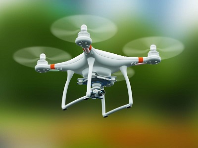
Why use drone technology for surveying & mapping

A few years ago The GEOSPATIAL Industry Underwent a Revolution, First, it was used total Station than Came GPS, Laser Scanner & even robotics too played a role in advancing it.

Today the technology which is gaining momentum in the industry is Drone technology due to its numerous benefits.

Now Professional are Adding another tool Mapping & Surveying Drones, Which Boast of quick Data Collection Excellent positional Accuracy and Safe operator Experience.

Benefits of Drone in surveying & mapping

  • A traditional Ground Survey team may need a moth to maps a difficult 100-acre site. But a Mapping Drone Can complete the same task in less than half an hour.
  • Surveying Roadways Floods areas or Congested cities Landscapes are perfect Assignments for Drone Technology.
  • Quick Data Collection From Fields.
  • Easy Completion of projects in areas that are difficult to Dangerous to access.
  • Survey Grade Accuracy with less time, less manpower, and less equipment.
  • Drones can fly closer to the Ground Surface and supply a much-improved resolution for areal surveying and photography.

Drones are Becoming an Industry Standard and Customers are Asking for UAV Surveying.