


Twice the efficiency of conventional methods
Developed, manufactured, and marketed by Aerosense, the cumulative shipment of GNSS surveying equipment “AEROBO marker” has surpassed 1,000 units. The product is widely used in construction industry by Construction Companies, Consultants, Surveyors as well as Land & Property Planning officials nationwide.
As the labor shortage in construction and survey industries continues, there is a growing need to work as efficiently as possible. To meet these needs, we have continued to develop the AEROBO marker. We have compared the workflow with conventional methods and the results show that users can expect a two-fold increase in productivity.
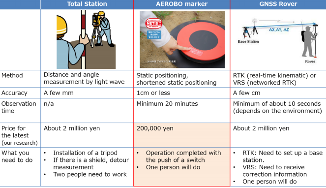
Hardware comparison
AEROBO marker employs static positioning, providing the highest level of accuracy of any GNSS receiver, and at a price of some 1/10 of modern survey instruments. Furthermore, the system is so simple to use that even the layman can deliver professional results.
(Survey equipment comparison table)
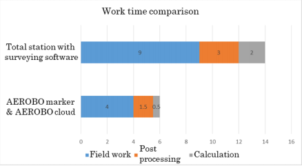
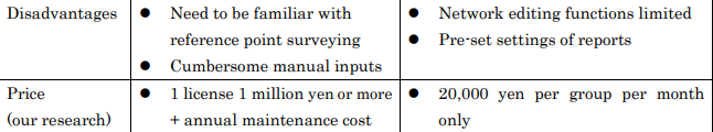
Software comparison
Using a Total Station, it would typically take two people one day on-site to set 25 new survey points. Then a further 3 hours of post-processing time using typical net average calculation software and another 2 hours for the calculations, meaning 14 work hours in total, Using AEROBO markers and AEROBO cloud, we were able to confirm that we can increase the efficiency by 60% with a total of 6 hours for installation and measurement of AEROO markers, and automatic network average calculation done by AEROBO cloud.
(Work time comparison graph)
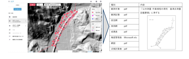
AEROBO cloud implements and automatically calculates the procedures required for reference point surveying, making it both considerably easier and quicker to generate a polygonal network and output the necessary reports. If one has a good survey plan, it can be an effective tool for leveraging human resources and reducing survey costs.
(Example of automatic calculation and report output of reference point survey by AEROBO cloud)
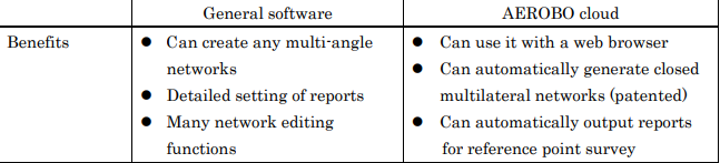
(Survey software comparison table)
Aerosense will contribute to enhancing the global infrastructure standards by expanding the sales of AEROBO markers in countries and regions where financial and technical hurdles to adopt the latest surveying equipment in conventional methods are too high to be penetrated.


