


In recent years, Romania has experienced devastating floods that have caused significant damage to infrastructure, homes, and businesses. These floods have had a severe impact on the lives of many Romanians, and authorities are constantly seeking ways to reduce the impact of these natural disasters. One of the technologies that has proven useful in flood management is LiDAR scanning. According to Romania’s Sustainable Development Strategy 2030, the achievement is one of the primar goals of sustenability known as clean water and sanitation, meant to increase the quality of life infrastructure and public services.
The development of LiDAR scanning, along with the advancement of UAV platforms, has revolutionized mapping, topography, environmental monitoring, and other similar applications.
LiDAR, Light Detection and Ranging, is an active sensor technology that uses laser pulses to create a three-dimensional image of the terrain. Incorporate with UAV equipment, LiDAR can be used to map hard-to-reach or risk areas, such as mountainous regions or flooded terrain, and more.
This technology has traditionally been used in mapping and topography, but it has increasingly various applications in collecting topographic data necessary for water basin management, particularly useful in flood management as it provides precise and detailed information about the topography of an area, which can be used to predict the impact of floods.
In addition to flood management, LiDAR scanning has other potential applications, ranging from archaeology to forestry and urban planning. As the technology becomes more widely available and accessible, we can expect more innovative applications of LiDAR in the future.
Water is an indispensable resource that plays a vital role in sustaining the well-being of individuals, as well as for agriculture and industry. To manage water basins and prevent floods and other natural disasters, it is crucial to have precise and detailed terrain data. Human factors as well as climate changes can lead to considerable modifications of natural water resources. To ensure the planet’s thrieving, we must count comprehensive reforms that adress the environmental conservation, sustainable resource management and ecosystem cooperation. In order to efficiently and easily monitor changes regarding the nature and dimension of hazard events, new approaches like LiDAR technology are needed.
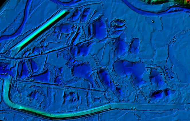
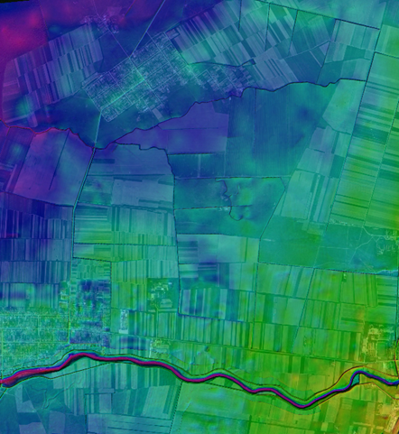
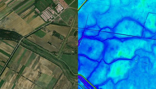
One of the most important aplicability of LiDAR technology within water basins is creating precise relief maps. These maps can be used to predict areas with high risk of flooding or landslides and to develop hazard management strategies. Additionally, LiDAR maps can be used to assess hydroenergy potential and identify sources of drinking water.
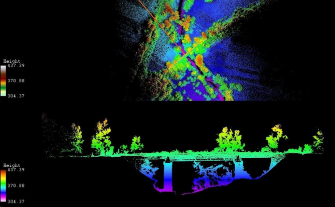
LiDAR data can be used in hydrology to estimate surface water flow, which estimates the flood risk, 3D landscape modeling of land cover changes. This type of surface data collection is one of the most effective methods for assessing hazard risk. It can be applied for detecting changes in river levels or measuring the amount of snow in mountains, which can indicate future water levels in rivers and lakes. In Romania, LiDAR scanning has been used to create precise flood maps, which are essential in developing effective flood management strategies. These maps represent the potential expansion of floods in one specific area, including the depth and speed of floodwaters, merging the collected data, using LiDAR technology with bathymetric data. This information is crucial in determiningevacuation routes, identifying vulnerable areas, and developing flood warning systems.
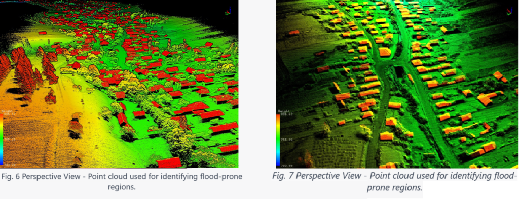
LiDAR scanning has been used as well in multiple locations in Romania to identify flood-prone areas. With the help of LiDAR scanning technology, local authorities were able to identify areas prone to flooding and develop flood management strategies to reduce the impact of floods.
Regarding the benefits, using LiDAR technology can lead to increased accuracy and precision of terrain data, as well as improved efficiency and effectiveness in collecting and managing topographic data. This can be helpful in preventing natural disasters and protecting communities and infrastructures in affected regions.
In conclusion, the development of LiDAR scanning along with UAV equipment has opened up new opportunities in mapping, topography, and hydrographic basin management and associated natural risks such as floods and landslides.
Contributing to the development of more efficient risk management strategies, LiDAR and UAV technologies can help create precise relief maps and monitor real-time changes in the terrain. This combination offers a more efficient, precise, and faster solution than traditional methods, allowing for a better understanding of the surrounding world and real-time decision-making.

Simion BRUMA – certified surveyor with over 15 years of experience in surveying, cartography, cadastre, and forestry.CEO at BDS Topografie SRL (www.bdstopografie.com), Vice President of the Romanian Geodetic Union – Cluj Branch (www.ugr.ro)


