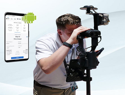
Professionals may now capture high-accuracy laser offsets directly into ArcGIS Field Maps on Android devices with Arrow Series GNSS receivers
Eos Positioning Systems announced its release of its popular Eos Laser Mapping for ArcGIS solution on Android devices. Previously the free solution, which allows mobile crews to capture asset locations from a distance with survey-grade accuracy, was available only on iOS.
“We are excited to provide this already popular iOS solution also to our customers using Android devices,” Eos Chief Technology Officer Jean-Yves Lauture said.
The solution combines market-leading technology from geographic information system (GIS) provider Esri, laser rangefinders from Laser Tech (LTI), and Eos’ own popular Arrow Series GNSS receivers.
“The Eos Laser Mapping solution was extremely well-received with its initial release, so we are excited to see the same features now available for ArcGIS Field Maps users on Android devices,” Esri Field Apps Engineering Lead Jeff Shaner said.
The Eos Laser Mapping release on Android currently supports three workflows, or mapping methodologies: Standard Laser Offset (sometimes called Range-Azimuth), Range-Range (or Range-Intersect), and Range-Backsight (a total station-like method).
The original laser offset solution was released in 2018 by Eos in partnership with Esri and LTI.


