


TOPODRONE, a Swiss based designer and manufacturer of high-precision lidar equipment for installation on drones, vehicles and backpacks, has announced the synchronization of LiDAR PRIME scanner and aOrion Heli-E UAV enabled by Velodyne’s Alpha Prime sensor. This new mapping solution fills the gap between heavyweight and expensive manned aerial lidar systems and lightweight drone lidar systems. It allows users to expand their applications to survey large areas that were previously only possible to survey using manned airplanes or helicopters.
High-Precision Aerial Lidar Mapping – TOPODRONE
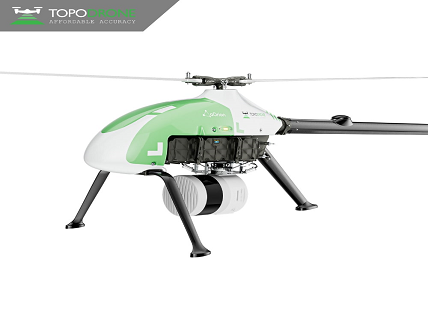
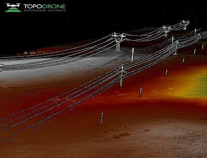
LiDAR PRIME is TOPODRONE’s most advanced lidar system, with a working range up to 300 meters covering a 500-meter corridor width and more than 20 km2 per flight with the aOrion helicopter. LiDAR PRIME + aOrion Heli-E system is enabled by the Alpha Prime sensor, Velodyne’s world-class, long-range lidar sensor. ‘The system provides users the opportunity to capture tens of kilometers of power lines, dozens or even hundreds of square kilometers of a surveying area when a manual inspection, piloted helicopter or a multicopter bring too much risk, high expenses, or can not meet the challenge’, Maxim Baklykov, CEO at TOPODRONE, explains.
Velodyne’s lidar provides TOPODRONE the outstanding quality, working range and capabilities for Aerial Lidar Mapping solutions. The partnership with Velodyne has helped TOPODRONE to substantially increase the number of products for the surveying and mapping markets. TOPODRONE’s coming models based on Velodyne’s sensors can continue to help provide game-changing technology for the market over the next year.


