Enabling Precise Positioning for Agriculture, Construction, Mapping, Surveying, Robotics and Trucking
ACEINNA partner with Point One Navigation to enables a streamlined positioning platform which combines Point One’s Polaris GNSS cloud correction service with ACEINNA’s OpenRTK330 hardware and software solution for developers in agriculture, construction, mapping, surveying, robotics and trucking.
The GNSS correction service market shows great promise yet is presently hampered by some lingering problems. These include: the nuisance of managing separate commercial/support relationships for hardware and subscriptions, difficulty integrating solutions between such providers, lack of consistency in resulting accuracy compared with what is advertised, resistance to supporting all application sizes from single unit to high volume, the absence of a coast-to-coast network from a single provider, and stubbornly high pricing for the service in general.
ACEINNA and Point One are solving these problems by delivering the most reliable, turn-key and affordable GNSS correction solution on the market. Customers will be able to purchase the fully integrated hardware and streaming service directly from ACEINNA and its distribution partners versus seeking out a provider on their own. Activation and authentication will be streamlined thanks to extensive backend server synchronization between ACEINNA and Point One. True centimeter-level accuracy will be attainable and powered by the integration of Point One’s coast-to-coast Polaris network and ACEINNA’s OpenRTK platform. Finally, aggressive pricing will be offered to support all deployment levels, from single unit and up through large scale. The combined offering will be available for purchase beginning in December 2020.
“This partnership between ACEINNA and Point One harnesses and combines each of our distinct strengths, to offer a solution platform that makes high performance positioning accessible to a variety of industries and applications. We are thrilled to work with Point One’s technical expertise and execution to advance this technology to the next level of precision,” said Dr. Yang Zhao, Chairman and CEO of ACEINNA.
“Point One’s Polaris is a highly adaptable network that provides critical data for a myriad of precise positioning and autonomous applications,” said Aaron Nathan, CEO and Co-Founder at Point One. “We are excited to be working with an industry leader such as ACEINNA and the use of OpenRTK330 satisfies a market need for precise yet affordable corrections-based guidance and navigation systems.”
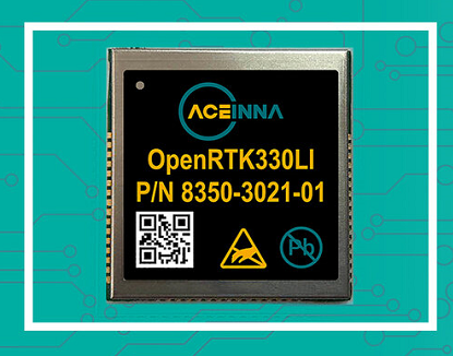
OpenRTK330 is a state-of-the-art, high performance GNSS receiver with a built-in RTK engine and triple redundant inertial sensors. It is designed for use in Level 3 ADAS and other high-volume applications requiring precise position information. It includes a multi-band RTK/GNSS receiver coupled with redundant inertial sensor arrays to provide cm-level accuracy, enhanced reliability, and superior performance during GNSS outages. The dead reckoning solution delivers strong performance in GNSS challenged urban environments. OpenRTK300 is supported by ACEINNA’s open-source tool chain which enables direct customization of the on-board algorithms, I/O, and communication stack on the device
Point One’s Polaris network is a proprietary GNSS correction network built from the ground up for the needs of modern automotive and robotics customers. Polaris uses the latest in base station technology including advanced anti-jam, interference mitigation, security and integrity monitoring. Its powerful cloud-based correction architecture allows for GNSS corrections in RTK or SSR configuration. Its open source interfaces demonstrate compatibility with receivers and chipsets from leading providers. The service is also compatible with any NTRIP/RTCM3 compliant receiver.


