


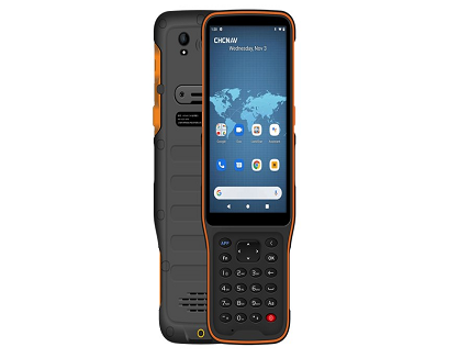
HCE 600 exceeds all the requirements for your Field Surveying Applications
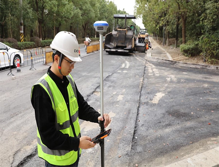
CHC Navigation (CHCNAV) announced the HCE600, a professional, lightweight, and compact field data collector with an alphanumeric keypad specifically designed for field surveying and mapping operations. With connectivity modules including Bluetooth 5.0, dual-band 2.4G and 5G Wi-Fi, and 4G modem, the HCE600 connects seamlessly and reliably to GNSS receivers and RTK network correction sources.
To withstand harsh surveying and weather environments, the HCE600 is designed to survive shock, dust, and water. Its 5.5-inch Asahi DragonTrail HD+ display is ultra-rugged and scratch-resistant, providing long-term performance and great protection against everyday wear and tear or accidental drops from up to 1.5 meters. The HCE600 also comes with a 90-day trial version of the LandStar Surveying and Mapping App, which integrates cloud services to easily share data and enable one-click remote support from anywhere.
- Powered by an 8-core processor and Android 10
Integrating the powerful 8-core Helio MTK 6762 processor, the HCE600 delivers the best performance, runs 50% faster, and consumes 25% less power than its predecessors. The Android 10 operating system enables smooth CAD drawing management and base map display without delay, resulting in increased productivity. High-performance LPDDR4 memory transfers data faster, allowing for instant uploads of large project files.
- High brightness 5.5-inch HD+ display
The high-resolution screen displays complex surveys, DXF base maps, and data tables in incredible detail, enhancing the user’s viewing experience. With up to 500 nits brightness, data is easy to read in all weather conditions, whether in direct sunlight or in the rain.
- A sleek, lightweight, premium design
With a thickness of only 1.54 cm and a weight of 345 grams, the HCE600 is the ultimate ultra-light handheld for mapping applications. Based on an ergonomic design, its one-handed grip provides excellent control and great usability. A shortcut key on the side can be customized for one-step surveying and quick data entry.


