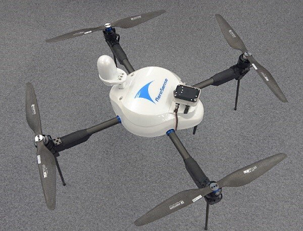
Aerosense Co., Ltd. will hold the Chiba Makuhari Messe Exhibition Hall for three days from June 14th (Monday) to 16th (Wednesday), 2021, exhibiting at “Japan Drone 2021 6th – Expo for Commercial UAS Market-“.
Since its founding in August 2015, Aerosense has been working under the slogan of “Contributing to society by transforming with cutting-edge drones, AI, and the cloud and automating various tasks in the real world.” The company has aimed to realize a safer and more secure on-site environment in various industries and improve productivity. Each of these contributions leads to the Sustainable Development Goals (SDGs) adopted by the United Nations General Assembly in September 2015.
Aerosense will exhibit a new lineup of wired drone systems with fully automatic winders, agricultural drones, and surveying drones at this year’s Japan Drone Exhibition in order to further evolve those efforts. In addition, the company will introduce application examples including vertical takeoff and landing type fixed wing drones. In addition, they are consistently developing, designing, manufacturing and selling in Japan, including all drone housings and flight controllers.
(1) AEROBO ON AIR (AS-MC03-W2)
[WIRED POWER SUPPLY / VIDEO TRANSMISSION DRONE SYSTEM WITH FULLY AUTOMATIC WINDER]

Fully automatic winding / unwinding function enables vehicle cooperation in disaster investigation, construction, firefighting, broadcasting / wireless relay, etc.
Power is supplied by a power supply cable and signals are controlled by an optical fiber cable, so the drone can be operated safely and securely, and the camera can be finely controlled.
Equipped with IP43-equivalent dustproof and waterproof performance, safety functions such as an indicator and voice alert for the fully automatic winder “Aero Boriel” (AS-IAR01), and an earth leakage breaker.
(2) AEROBO SPECTRUM (AEROBO SPECTRAL, AS-MC03-MS)
[PPK COMPATIBLE AGRICULTURAL DRONE WITH DUAL FREQUENCY GNSS]

Equipped with a multi-spectral camera (MicaSense® ALTUM) as standard equipment for agriculture
Achieves highly accurate field sensing without going around the site with PPK
Various vegetation analysis (NDVI, RGB, etc.) is possible with Aerovo Cloud
* Operation aircraft of the Ministry of Agriculture, Forestry and Fisheries Smart Agriculture Demonstration Project
③ AEROBO PPK (AEROBO PPK, AS-MC03-PPK)
[DRONE FOR SURVEYING COMPATIBLE WITH PPK EQUIPPED WITH DUAL FREQUENCY GNSS]

Equipped with a higher performance dual frequency GNSS receiver
Calculate the aircraft position with high accuracy using PPK (Post-processing Kinematic)
Since it is possible to significantly reduce ground anti-aircraft markers (aerobo markers, etc.) by processing with PPK, the number of man-hours to go around the survey site is reduced.
④ AEROBO WING (AS-VT01)
[VERTICAL TAKEOFF AND LANDING TYPE FIXED WING DRONE (COMMONLY KNOWN AS VTOL)]

The one and only domestically produced VTOL (* according to our research)
With a maximum speed of 100km / h, a maximum flight distance of 50km, and a maximum flight time of 40 minutes, it can be used in a wider range of applications.
Supports various applications with high-power wireless and LTE support
Customizable payload up to 1 kg


